Announcements

10 Year Anniverary & New Releases Winners: Carrie Fancett Pagels' Butterfly Cottage - Melanie B, Dogwood Plantation - Patty H R, Janet Grunst's winner is Connie S., Denise Weimer's Winner is Kay M., Naomi Musch's winner is Chappy Debbie, Angela Couch - Kathleen Maher, Pegg Thomas Beverly D. M. & Gracie Y., Christy Distler - Kailey B., Shannon McNear - Marilyn R.
Showing posts with label Wilderness Road. Show all posts

Monday, December 10, 2018

The Travelling Church

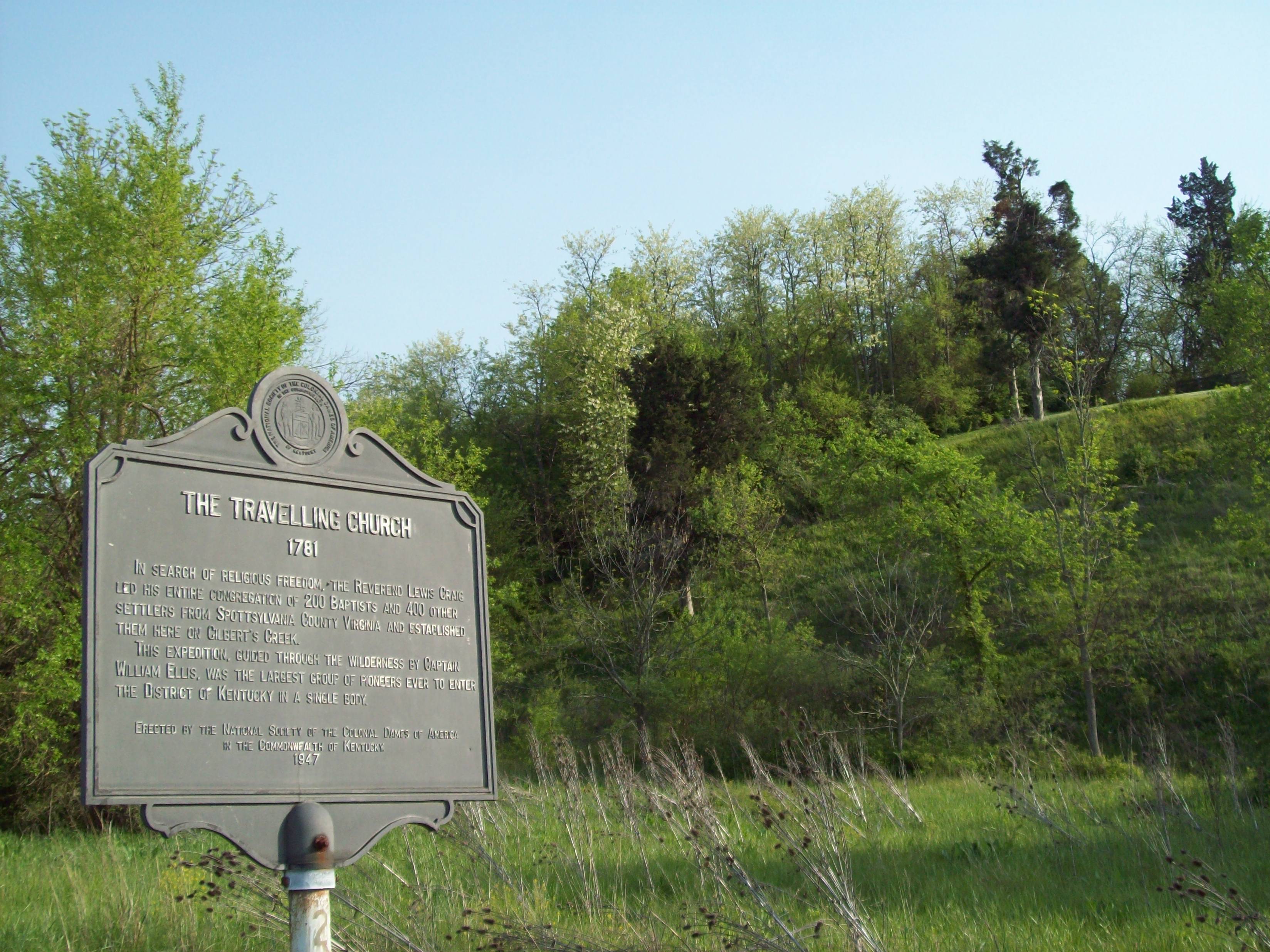
Kentucky State Marker #25
From Kentucky State historical marker #25:

In search of religious freedom, the Reverend Lewis Craig led his entire congregation of 200 Baptists and 400 other settlers from Spottsylvania County, Virginia, and established them here on Gilbert's Creek. This expedition, guided through the wilderness by Captain William Ellis, was the largest group of pioneers ever to enter the District of Kentucky in a single body.

So we remember “The Travelling Church,” which set out from Virginia in 1781 for the purpose of exploring the “Canaan” of Kentucky while furthering their missionary endeavors. In October 1781, they arrived in Fort Chiswell in southwestern Virginia with a considerable-sized wagon train, only to find that a hundred miles further, the road would become impassable to anything but horse and foot traffic. They then sold or traded off their wagons and larger household goods, packed things up, and set on down the road. Robert L. Kincaid gives this colorful description in The Wilderness Road:

It was a crushing blow for Craig and his people to give up their wagons so early in their journey. The women and the children hated to leave the luxury of wheels for a hard and uncertain horseback ride. But it could not be helped. Huge baskets and bundles of clothing, bed furnishing and household articles were prepared and lashed upon packhorses. Children were crowded on top, or rode in front and behind their mothers and relatives. The men and older boys who did not have mounts trudged along on foot. Thus accoutered, the company strung out on the road to the dark wilderness with its unknown terrors.
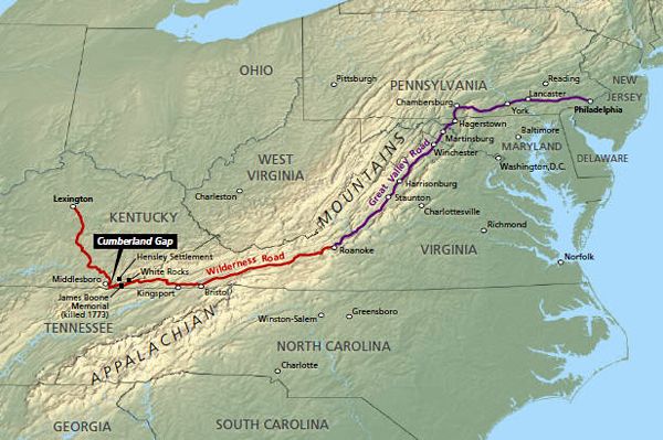
The Great Road (purple) and the Wilderness Road (red)
The group met with delays because of unrest with the Cherokee, wet weather that turned into cold and ice as winter approached. They learned of Cornwallis’s surrender while still in eastern Tennessee and rejoiced greatly over the news. Then, through eastern Tennessee, up over Cumberland Gap and down into southeastern Kentucky, they forded icy rivers and slogged through knee-deep mud in sloughs and canebrakes. Finally the weather eased a bit as they approached Crab Orchard, Kentucky, and at Gilbert’s Creek, in December 1781, they chose a spot for their new church home. This would be the third Baptist church in Kentucky, as two others had been founded earlier the same year.

So why would they do this? Why would almost an entire church leave home and possibly family behind? Obviously the party was comprised of far more than church members—some just wanted the material opportunities Kentucky had to offer—but the biggest reason, for the church itself, was religious persecution. During the colonial era, any church besides the one established by Mother England often came under serious heat from Anglicans. The leader of this particular congregation saw the western frontier as their best solution to this.

Is it possible there could have been a calling from God involved, as well?

~*~*~*~

Filed under the category of historical tidbits I didn’t manage to shoehorn into my recent release The Cumberland Bride. Thanks to Kincaid for his excellent if sometimes embellished work on the Wilderness Road, and to Wikipedia, which has gotten far more reliable over the past few years. :-)

Monday, May 14, 2018

The Wilderness Road and Cumberland Gap

Travel during colonial times was notoriously slow and arduous. I've written before about the Great Wagon Road stretching from Philadelphia down through western Virginia and into North Carolina, which had its origins as the Warrior’s Path, a highway of sorts between the northern and southern native tribes. The Wilderness Road, stretching from western Virginia, down into east Tennessee and up into Kentucky, had similar origins. Traffic between the upper Ohio Valley and the lower Appalachians traced a path down through the heart of the region famed as a favored native hunting ground, converging with the Warrior’s Path at the great Cherokee town of Chota, in southern Tennessee. Interestingly enough, that western trail was called Athawominee, “Path of the Armed Ones,” essentially a variation of Warrior’s Path like the one up through the Shenandoah Valley.

The first European recorded as having seen Kentucky and the Ohio Valley is Gabriel Arthur, a white indentured servant taken captive after an expedition gone badly during 1673. Directed by the Shawnee down the well-marked path that took him south to the Cumberland Mountains and eventually through Cumberland Gap then back northeast to Fort Henry (near present-day Petersburg, Virginia). No one at that time realized the significance of what Arthur had been shown, the best route over the Appalachian Mountains to the western frontier.

The area remained unexplored until 1750, when Dr. Thomas Walker mounted an expedition into what was then western Virginia, which in colonial times extended all the way to the Mississippi River. Others followed, including Daniel Boone and James Harrod, initially traveling companions but separating after a difference of opinion, and both with Kentucky towns named after them. Employed by the Transylvania Company to blaze the way for a road northward from Cumberland Gap, Boone led a company of thirty-some mounted and armed axmen in 1775. He and other longhunters had already been exploring this region for a decade and more, but he’s the one credited with first leading settlers over the pass called Cave Gap in the early days, and up into the lush, wild country called Kentucky.

Many early explorers wrote of their journeys, describing herds of bison, elk, and deer, flocks of turkeys and geese, rivers full of fish, canebrakes taller than a mounted man’s head, and tangled thickets of holly and laurel that afforded little grazing for the horses that carried them and their provisions. Bear and wolves ranged freely, drawn by the plentiful game. While hunting was easier than they’d ever dreamed possible, the land itself was poor for farming on the eastern side of the region. They wrote of the mountains and caves, of stream crossings complicated by sand and mud flats. More fearsome were Indian warriors, who often struck parties of explorers and later settlers without warning, taking captives and scalps and leaving terror in their wake.

And still, the settlers came, pouring over the Cumberland Gap on foot and by horseback long before the way was fit for wagon traffic. Some went north to the lower Ohio River Valley, via Boone’s Trace, as it was called, since travel down the Ohio was still too hazardous, made so by native tribes and white outlaws. Others went westward along Harrod’s Trace. In 1796, work was completed on an actual wagon road, commissioned a year or so before by the newly formed Kentucky legislature. There’s evidence that improvements began about 1780, with completion not taking place until after Kentucky gained statehood, but other sources say most improvements happened around 1792, with official work and opening in 1796. The latter is the timeline I used in my upcoming novel, The Cumberland Bride.

By the end of the colonial era, Westward Expansion was already well in motion, thanks to the Wilderness Road. Today, modern highways and interstates roughly trace the route, and a mountain tunnel eases traffic across the Cumberland Gap. The forests still look as wild, though, in between scattered towns that dimly recall their origins, and historic markers and sites bearing witness of the amazing journeys of those explorers, hunters, and settlers.